Lowest rainfall in 90 years as temperatures set to soar

 Little Leo/BBC Weather Watchers
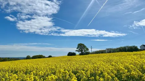
As Yorkshire prepares for what is expected to be the hottest day of the year so far, records show the region has endured its driest combined February, March and April for almost 90 years.
Just 78mm (3in) of rainfall has been recorded at Sheffield's Weston Park weather station since the start of February - the lowest since 1938.
Typically we would expect to see around 184mm (7in) and, by contrast, the same period in 2024 was the sixth wettest on record, when 300mm (11.8in) fell.
Temperatures could reach as high as 26C (79F) later - the average for late April is 14C (57F) - and though they are expected to fall later in the week there is little, if any, rain in the forecast as we head into May.
But, while the warm weather may be a boon to sunbathers and holidaymakers alike, it's not universally welcomed.
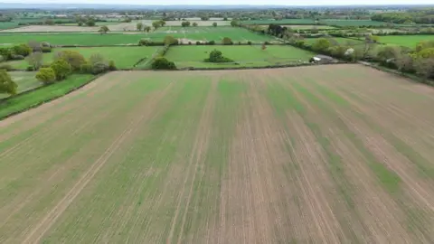
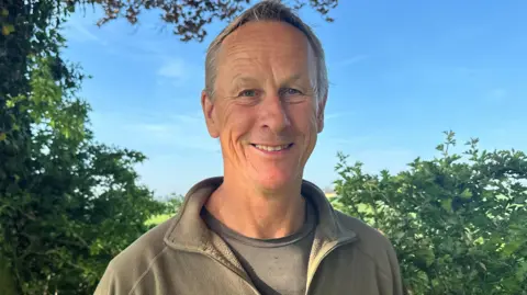
Take Dr Nick Wilson, an arable farmer in the Vale of York, who specialises in crops such as wheat and barley
He said he had only recorded 20mm (0.7in) of rain at his farm in the last 10 weeks. The contrast with last year when his crops were sitting in flooded fields couldn't be more stark.
"It's a crucial time of the year for the development of crops," he tells me.
"And with the lack of rainfall we are already looking at a 15% drop in crop yield.
"More worryingly, if we don't get any rain in the next week or 10 days, the yield could drop to potentially more than 20%."
 Submitted
Inevitably, this is likely to mean higher prices in the shops later in the year.
And farmers like Nick haven't recovered from the disastrous spring floods last year, which lead to another poor UK harvest
"We've been hit from every side at the moment, whether it's politically, economically or financially," he says.
"And this could just be another nail in that proverbial coffin. It's not good and farmers' mental health is really suffering."
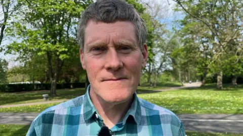
Jim McQuaid, from the Department for Earth and Environment at the University of Leeds, tells me no-one should be surprised by these increasingly frequent weather extremes.
In recent years we have seen numerous records broken in the UK - the most notable one in July 2022 when 40C was recorded for the first time - a temperature which scientists believed would have been impossible were it not for climate change.
"This is what the weather models have been telling us for a number of years, but now we're actually seeing it with our own eyes," Dr McQuaid says.
And there's evidence to suggest that the jet stream - so crucial in determining weather in the UK - is being impacted by our warming planet, leading to longer periods of the same weather.
It's a ribbon of fast-moving air high up in the atmosphere, formed by the clash between cold air in the Arctic and the much warmer air in the sub-tropics.
But the Arctic is becoming less cold - it is the fastest warming place on earth – and this is weakening the temperature contrast with the sub-tropics, which is so crucial in determining the strength of the jet stream.
This may be causing the jet stream to meander in the Atlantic - becoming slower-moving and so becoming stuck – leading to longer periods of either rainfall like we saw last spring or dry weather that we have seen since February.
And for farmers like Nick, who are desperate for some rainfall, the long range forecast doesn't offer much in the way of hope, with the first half of May expected to see a continuation of the drought.
I've been a meteorologist for 30 years, and there can be no doubt we are seeing patterns of weather becoming more extreme, not just the intensity of events, such as more rainfall, but the length of time these types of weather last.
The flooded fields with crops under water last year and the same fields this year with crops struggling to survive the drought illustrates our changing climate, with projections suggesting these patterns are only likely to become more extreme over time.
Listen to highlights from West Yorkshire on BBC Sounds, catch up with the latest episode of Look North.