Map shows 80% of peatlands dry and degraded

 BBC
BBCNew mapping data has shown 80% of England's peatlands to be dry and damaged.
The government said the findings, shown on an open source map, presented a worrying picture, with degraded peat emitting carbon into the atmosphere and contributing to global heating.
Healthy peat is the country's biggest carbon store but when damaged it releases planet-warming greenhouse gases into the atmosphere.
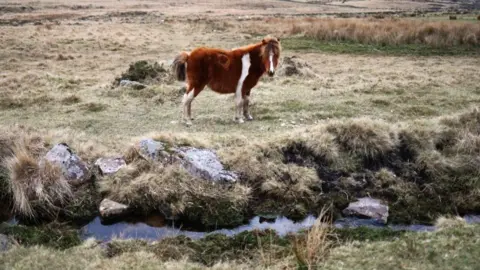
Meanwhile, the most extensive peatland habitat was shown to be found across parts of the Lake District, the Pennines, North York Moors and in the uplands of the south-west of England.
Scientists have used satellite imagery, artificial intelligence and in-depth data analysis to create the most complete map of England's peatland and peaty soils to date, the Department for Environment, Food and Rural Affairs (Defra) said.
As vital carbon sinks, healthy peatlands can help tackle climate change, reduce flood risk, improve water quality and support rare wildlife, including the golden plover, curlews and 25 species of dragonflies.
 EPA-EFE/REX/Shutterstock
The map models the extent, depth and important aspects of the condition of England's peat, including vegetation, gullies and man-made as well as natural draining channels.
It found that peaty soil covers roughly 8.5% of England's surface with four-fifths of England's peatlands also revealed to be in a dry and degraded state.
The map showed that three-quarters of the surface was shown to be covered by plants and land use types associated with dryer conditions such as heather, while only 1% is covered by important peat-forming plants such as sphagnum moss.
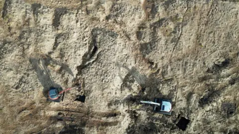
Cumbria Wildlife Trust said it was looking to restore some of its peatlands, which were historically burned to help heat homes last year.
Meanwhile, in Dartmoor, the University of Exeter estimates just 1% of its deep peat is healthy, peat-forming bog.
Efforts to restore this vital natural resource are under way, including in Exmoor, Dartmoor and Cornwall, but scientists are warning climate change could make that difficult.
Natural England's chief scientist, Dr Sallie Bailey, said: "Mapping peat to this level of detail will help us maximise the benefits of peat and massively advances our understanding the role our peatlands are playing in a changing climate."
Tony Juniper, chairman of Natural England, said the map "would allow us to make far better and more informed decisions when it comes to managing peatlands - targeting restoration efforts to the most degraded peat and identifying the best opportunities for nature recovery".