Unsettled New Year weather looms for West Country
 Rex Features
January 2025 is set to start with some potentially disruptive weather, the Met Office is warning.
On New Year’s Day, an area of low pressure will arrive from the west, threatening a spell of strong winds and squally heavy rain, before colder but overall calmer weather follows by Thursday.
The Met Office has issued a number of weather warnings nationally. One of these covers all of the West Country, cautioning of strong winds.
It is possible that some warnings may need revising, as the forecast details and likely impacts become clearer.
Strong winds and heavy rain
As of Monday, forecast computer models still differ regarding just how potent this system may become as it arrives into New Year’s Day, and exactly how it develops.
As a result, the exact scope of the strongest winds are yet to be predicted with high confidence.
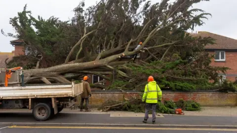
But there is potential for a period of disruptive winds in our region developing particularly by Wednesday morning, with forecast gusts about 40 to 60mph expected inland, and 60 to 75mph possible around some coasts of the Bristol Channel and adjacent uplands.
I expect the strongest gusts in the West Country from this system to be focused into parts of North Devon and West Somerset, along the A39 corridor. But it will become noticeably windy everywhere, overnight from New Year's Eve and through the first half of New Year's Day.
A period of heavy, squally rain is also expected to move south-east on a cold front during the first day of the year. This will combine with the strong winds to give a period of difficult conditions on the roads. Some disruption is also likely for transport by air and perhaps rail, with localised flooding possible.
As the deep area of low pressure departs east by Thursday, colder air will then spread south in its wake. The drop in temperature will become very noticeable, both by day and night, for Thursday, Friday and quite probably Saturday too.
A cold early January?
But exactly how our weather then unfolds through early January is very uncertain.
Following the colder but drier, calmer shot of weather developing after New Year’s Day, the next big question is whether temperatures continue below average for longer during the first fortnight or so of 2025, or instead fairly quickly trend back into a milder regime - at least here in the south-west.
There is a possibility that colder conditions could re-establish across more of the country during early January, while at the same time, low pressure systems with milder, moister air approach up towards us from the south-west.
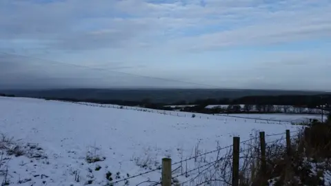
In these situations, the boundary between any rain-bearing fronts encountering the colder air can give rise to snow. Some, but most certainly not all, forecast models hint at this sort of potential during the second week of the month.
 Ian Fergusson
When these scenarios do occur, they are inevitably fickle and often subject to considerable forecast flux - not least in pinpointing exactly where snow may fall, versus those areas where milder air wins and delivers just rain or a sleety mix.
Just a few miles north or south, or a mere 100m of elevation, can bring very different outcomes.
So, be cautious of any bullish forecasts or hyperbole you might read at this early range of January snow being any sort of certainty for the West Country.
This potential could change markedly, or even completely vanish as a possibility from the forecast computer models.
Such is the awkward nature of forecasting snow chances in southern England at anything beyond about 12 to 24 hours ahead.
Follow BBC Somerset on Facebook and X. Send your story ideas to us on email or via WhatsApp on 0800 313 4630.
